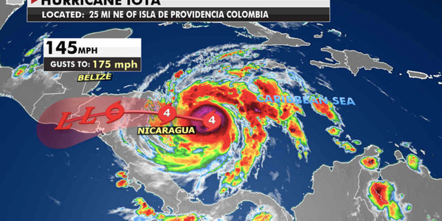
Hurricane Iota will make landfall in northern Nicaragua as a major category 4 hurricane late Monday night or early Tuesday morning.
The region is extra vulnerable as it is still recovering from being hit on Nov. 3 by category 4 hurricane Eta. Iota is forecast to bring 150 mph winds and as much as 30 inches of rain in some areas. The region is mountainous, so flash flooding and mudslides will be a serious threat. After landfall, the storm moves into Honduras. The rugged landscape will likely weaken the storm, but it will still bring heavy rain into interior Central America.
“Iota has continued to strengthen into a dangerous category 4 hurricane expected to bring potentially catastrophic winds, life-threatening storm surge, and extreme rainfall impacts to Central America,” explained the National Hurricane Center early Monday.
HURRICANE IOTA NOW A DANGEROUS CATEGORY 4 STORM AS IT HEADS TOWARD CENTRAL AMERICA
Hurricane Iota’s path (Fox News)
(Fox News)
A hurricane warning is in effect for Providencia, the coast of Nicaragua from the Honduras/Nicaragua border to Sandy Bay Sirpi and the coast of northeastern Honduras from Punta Patuca to the Honduras/Nicaragua border.
CLICK HERE TO GET THE FOX NEWS APP
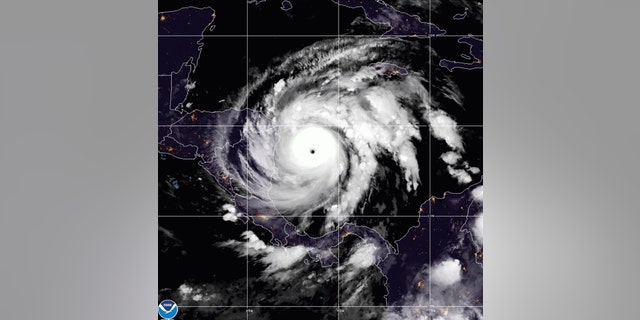
This satellite image made available by NOAA shows Hurricane Iota in the North Atlantic Ocean on Monday, Nov. 16, 2020, at 07:11 EST.
(NOAA via AP)
Meanwhile, in the United States, a series of Pacific storm systems will keep a large portion of the West unsettled this week. Expect locally heavy rain, heavy mountain snow and wind gusts across the Pacific Northwest to northern California. In southern California, elevated fire weather conditions are forecast due to try conditions and gusty winds.